In the late 1960s and early 1970s, opposition to the war in Vietnam had grown to a huge mass movement.
This piece of remnant graffiti promoting the cause still exists (as of yesterday!) in the railway underpass at Arncliffe in Sydney. I wonder if there is any elsewhere?
The Moratorium against the Vietnam War began in the United States, with the first Moratorium march on 15 October, 1969. This followed anti-war marches on the United Nations and Pentagon in 1967. On 15 November, 1969, 500,000 people marched on Washington DC.
In Australia the first marches took place on 8 and 9 May, 1970. Over 200,000 people took part, 100 000 in Melbourne. It was the largest mass movement against the war to that time. The second was in September 1970 and the third in July 1971. By this time, public opinion was turning decisively against conscription and Australia's involvement in the war.
Monday, 23 June 2014
Tuesday, 14 June 2011
The A to Z of 2205: Firmstone Gardens
Named after Mr H.A. Firmstone, the Mascot real estate agent who owned the land and subdivided it. (Source: The origins of the street names of the municipality of Rockdale, compiled by R.W. Rathbone, 1990)
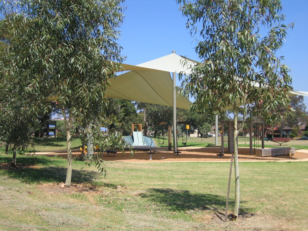
Firmstone Gardens runs off West Botany Street. Its most distinctive feature is the large Riverine Park.
![]() |
| I once went to a protest meeting in Riverine Park - protesting against development. This would have been in the early 2000s |
![]() |
| Older 1940s and 50s style red-brick houses are being replaced by larger, more modern rendered ones. |
![]() |
| Beautiful example of red-brick suburban style, with roses along the fence line. |
![]() |
| Meandering front fence |
Labels:
A to Z : F,
Arncliffe,
community facilities,
Every street in 2205,
Parks
Monday, 13 June 2011
The A to Z of 2205: Farrar St
Farrar St - named after Alderman F.H. Farrar, MBE, an alderman of Rockdale Council 1920-28. Previously called Gordon St. (Source: The origins of the street names of the municipality of Rockdale. Compiled by Alderman R.W. Rathbone, 1990)
It's a pretty street, running between Forest Rd and Wollongong Rd, with some lovely older houses. The most distinctive feature is the old fire station on the Forest Rd corner.
![]() |
| From Forest Road looking down Farrar St |
![]() |
| The old Arncliffe fire station, on the corner of Farrar St and Forest Rd. Now a preschool |
![]() |
| Panoram of the old fire station |
![]() |
| Looking down Farrar St from Forest Rd end |
![]() |
| It is very unusual to find a tennis court in the suburbs these days. I must revisit soon to see if this has been developed! |
![]() |
| A lovely sandstone fence. The house has nice views because Farrar St is at the top of the Forest Rd ridge |
![]() |
| A tranquil garden setting |
![]() |
| From Wollongong Rd end |
![]() |
| From Wollongong Rd end |
![]() |
| From Wollongong Rd end |
Sunday, 23 August 2009
The A to Z of 2205 : Fairview St

Fairview St runs between Fripp St and Wolli Creek Road. It was named after "Fairview", the Wollongong Rd home of Alexander Milsop. Milsop was the first Mayor of neighbouring municipality, Hurstville.
Below: Looking down Fairview St from Wolli Creek Rd.

Below: Political viewpoints near Wilson Rd


Below: Feed the birds at Wilson Rd


Below: The back of Macquarie Lodge, the Salvation Army Aged Care residence which fronts on Wollongong Rd - the former grand house 'Dapeto' is part of the complex.

Below: These boats seem permanently parked in the street.


Below: Front yard sculptural installation

Below: Olive trees aren't a common front yard tree, but these ones look terrific in front of a traditional California Bungalow.

Below: Plastic bottle tree?


Below: Garden at the corner of Fripp St

Below: Looking back up Fairview St from Fripp St
Labels:
A to Z : F,
Arncliffe,
Dappeto,
Every street in 2205,
Fairview,
Gardens,
Milsop
Saturday, 22 August 2009
The A to Z of 2205 : Eve St

It has taken a fair while between posts to get this street up. Eve St has lots of interest to me, mainly because it is adjacent to some fascinating wetlands.
Eve St was named after an early landowner in the area, Benjamin Eve.
In inner urban Sydney there are some remnant natural habitats which have been degraded over the years. It's always a battle to protect them, and the Eve St salt marsh wetlands are no exception. They are bordered by a motorway and recreational lands, including a bike path and golf range. Efforts have been made in more recent years to rehabilitate them. They provide a haven for local and international birds who come to feed and rest there.
I am not sure of its status at the moment; last time I was there access was denied (officially).
Eve St also has a bikepath along it which I've ridden a few times. It connects Marsh St with the continuation of the path to Kyeemagh and Botany Bay. [In the other direction you can reach Sydney Olympic Park at Homebush and Ryde].
The entrance to Eve St is from busy Marsh St, just near the Wickham St intersection, or from Brennans Rd off West Botany St. It is a no-through road at its southern end, where the cycleway continues along the Barton Park Golf Range.
We'll start our look at Eve St from the Marsh St end.
Below: Looking along Eve St from Marsh St

Below: Looking slightly northeast from Marsh St across the reserved land towards the M5 motorway

Below: Looking southeast from the corner you can see the Arncliffe fire station, on West Botany St/Wickham St intersection

Below: Across that patch of grass in the photo above, visible in the adjacent backyard is this old sandstone outbuilding:

Below: Looking towards Marsh St from near the elbow bend in Eve St:

Below: Part of the way along this stretch is Eve St Reserve

Below: The M5 from Eve St Reserve

Below: Eve St Reserve on the right, and straight ahead the cycleway where it joins Eve St, having come under the M5 from Marsh St.

Below: Looking across to the reserve from the end of the cycleway

Below: Images of the cycleway as it curves under the M5


Below: The wetlands from the cycleway


Below: The Wetlands

Below: Access denied

Below: The wetlands


Below: Looking along Eve St towards the cycleway (which joins at right at the bottom)

Below: Enjoying the cycleway


Below: From the crest of the hill, looking north


Below: Looking south over the golf driving range


Below: And the cycleway continues towards Botany Bay
Labels:
A to Z : E,
Arncliffe,
cycleways,
Every street in 2205,
M5 Motorway,
Parks,
Plantlife,
Walkways,
waterways,
wetlands,
wildlife
Subscribe to:
Posts (Atom)