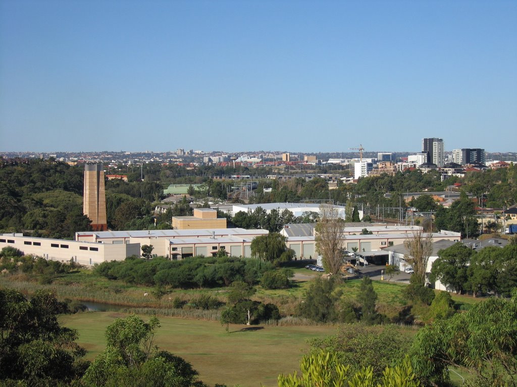
 View from Nannygoat Hill. Shows the M5 exhaust stack, the creek, East Hills railway line, the high rise development on and near the Tempe House site at North Arncliffe (now renamed Wolli Creek). Sydney Airport is in the distance.
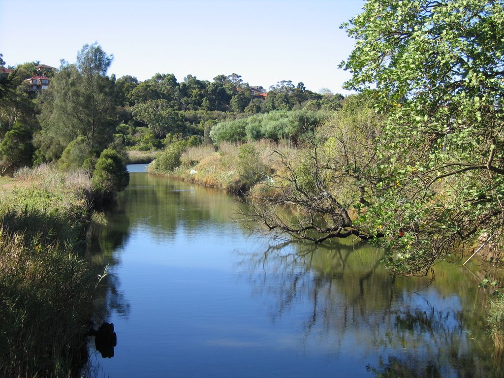 Wolli Creek looking downstream. A lovely urban creek. Generations of local kids have played in and around the creek and its bushland valley.
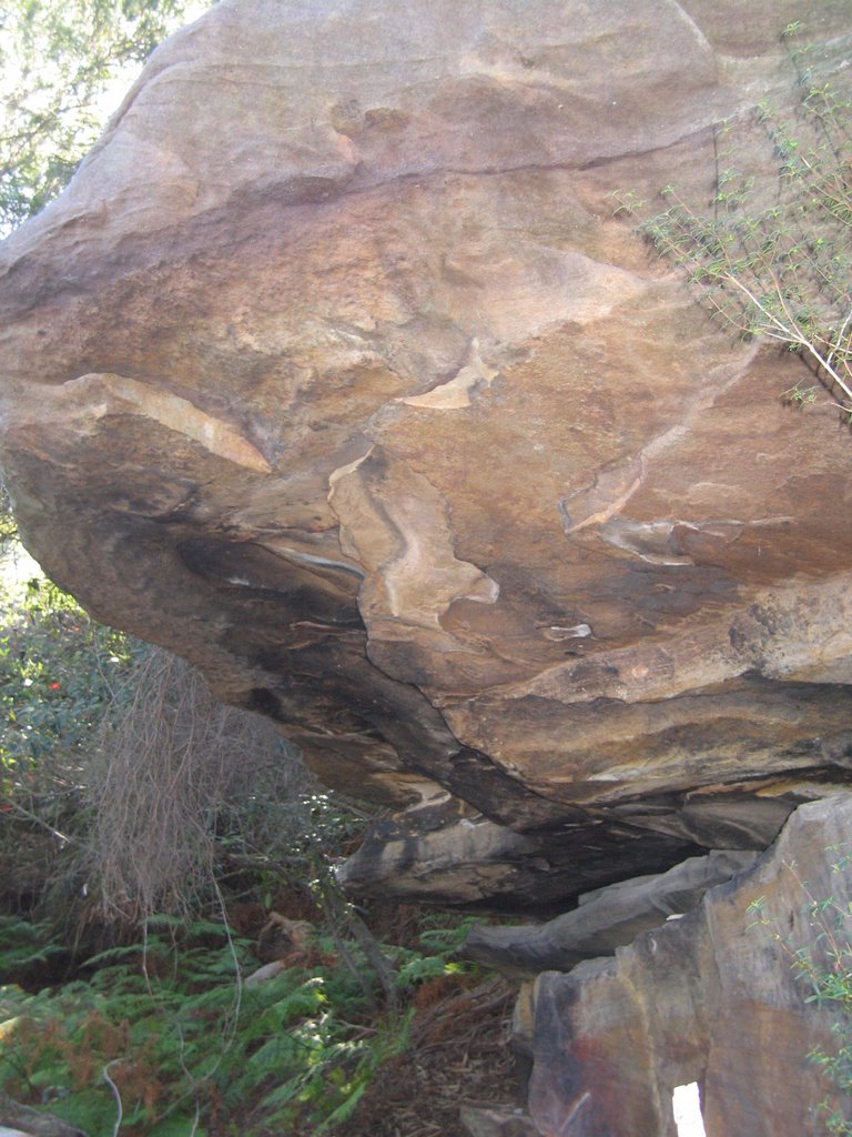
 Nannygoat Hill. A 1967 proposal, defeated by local residents would have seen this hill levelled to provide fill for the Sydney Airport runway. The original 1978 plan for the F5 Freeway would have seen the east side (right hand side) of the hill completely removed for an 8-lane highway.
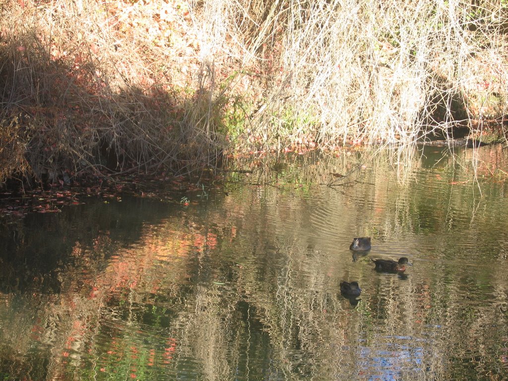
Ducks on Wolli Creek. There is also a myriad of local bird species living in and around the creek.
Wolli Creek is a tributary of the Cooks River. Upstream it is mainly confined to a channel, but through Postcode 2205 it is more or less “natural”. It flows into the Cooks River at Tempe railway bridge (you can see the railway bridge in the previous blog).
The Wolli Creek Valley contains the last patch of genuine bushland in the inner southwest of Sydney. It was under real threat when the M5 Motorway was planned to run through it. Fortunately strenuous campaigning by locals such as the Wolli Creek Preservation Society was successful in making the government decide to put the tollway underground (which has caused other problems not least pollution in the tunnel through inadequate ventilation, and the single smoke stack visible in the valley.
The valley is not safe yet – the road reservation has not been lifted, and there are delays in the development of the promised Wolli Creek regional Park, announced six years ago by the state government.
For more information, visit the Wolli Creek Preservation Society.