There's a few notable things about Duff St: the views to the city of Sydney, the air intake area for the M5 tunnel which travels underneath, and some contemporary architecture. I have it on good authority rather close to home that it's also a favourite for kids hurtling down on their bikes!
 Below:
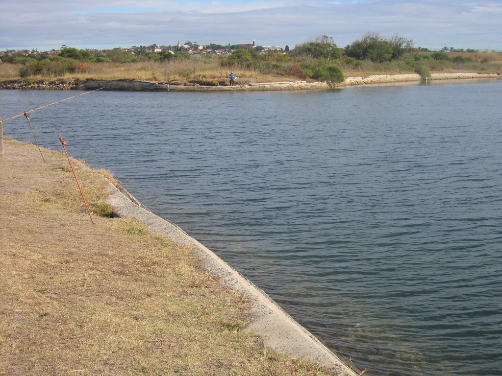
 Land for sale right next to the air intake vent for the M5 motorway tunnel. This tunnel has been the subject of much controversy, since before it opened. It has not had an air filtration system within the tunnel. Air was taken in here, and expelled, unfiltered, through a stack in Henderson St (Turrella) - we'll see it when I get to "H" for Henderson! Anyway, after many protests, much pressure on the government, demonstrable sickness of residents, and the fact that subsequent tunnels were built with filtration systems, a filtration system is being installed in this tunnel.

 Below:
 The white buildings in the distance are associated with Sydney Airport.
 Below:
 Duff St is a dead end at the western end, with a walk way down the hill not visible to the left.

 Below:
 Sydney CBD. You can see the Harbour Bridge and Sydney Tower quite clearly.

 Below:
 Looking down the hill towards Hirst St and the corner of Arncliffe Park
 Below:
 The Hirst St intersection - lookign across to Mitchell St, which runs alongside Arncliffe Park.
 Below:
 Looking up Duff St from Hirst St


 Below: Land for sale right next to the air intake vent for the M5 motorway tunnel. This tunnel has been the subject of much controversy, since before it opened. It has not had an air filtration system within the tunnel. Air was taken in here, and expelled, unfiltered, through a stack in Henderson St (Turrella) - we'll see it when I get to "H" for Henderson! Anyway, after many protests, much pressure on the government, demonstrable sickness of residents, and the fact that subsequent tunnels were built with filtration systems, a filtration system is being installed in this tunnel.
 Below: The white buildings in the distance are associated with Sydney Airport.
 Below: Duff St is a dead end at the western end, with a walk way down the hill not visible to the left.
 Below: Sydney CBD. You can see the Harbour Bridge and Sydney Tower quite clearly.
 Below: Looking down the hill towards Hirst St and the corner of Arncliffe Park
 Below: The Hirst St intersection - lookign across to Mitchell St, which runs alongside Arncliffe Park.
 Below: Looking up Duff St from Hirst St