Tuesday, 10 October 2006

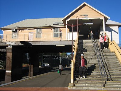
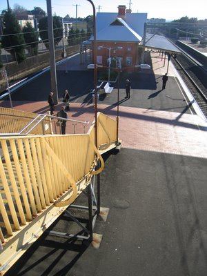
Arncliffe Railway Station

above: September 2000

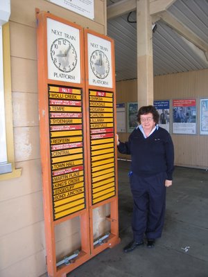
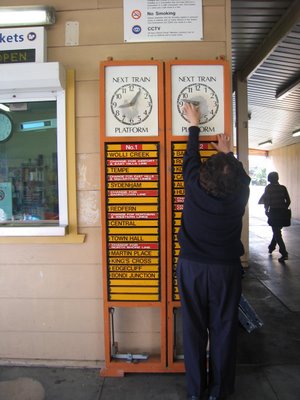
8 Sep 2006 - the old indicator boards - soon to be no more.


above: Iron lace work feature, typical of Victorian architecture

The Illawarra railway line, linking Wollongong and the South Coast with Sydney was talked about and supported from the 1860s. At the 1874 election, the voters of west Botany Municipal District enthusiastically supported those candidates who supported the extension of the railway.
By 1878 the route of the line through Arncliffe was clearly defined, and in on 30 November 1881, was approved by Parliament. The result was a modest population explosion, and a lot of subdivision in the Arncliffe area.

The railway opened in October 1884.

Arncliffe station is a beautiful example of Victorian architecture.


Update 22 Feb 2008. Taken Jan 24, 2007 - The electronic boards arrived. Unfortunately they are almost impossible to read; as the light hits the screens they are illegible. That's progress.

Monday, 7 August 2006

Arncliffe Park Part 1

Arncliffe Park is bound by Wollongong Road, Mitchell St, Hirst St and Broe Avenue. It was originally a Chinese market garden, the property of Kim Too. In March 1889 it was officially proclaimed as a public park.

Before WW1, Wollongong Road grocer, Hugh Wilkins, a Rockdale Council representative 1911-1917, complained bitterly about the lukewarm attitude of police to the "Push" which frequented the park and had attacked "a respectable Chinaman", about footballers undressing in the park, and of people playing cricket and cards on Sundays.

Estate agent Arthur Goddard, a representative of the area 1908 - 1914, criticised the use of the park by open air motion picture operators and the Arncliffe Brass Band playing "ragtime" music in the park on Sundays.


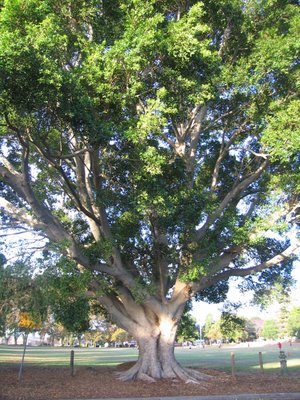
A very big tree in Arncliffe Park
Soccer and cricket are played in the park.

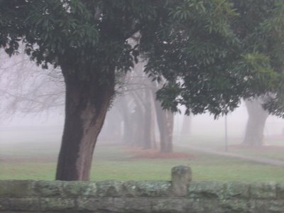
Fog in the park - June 2006


The War Memorial

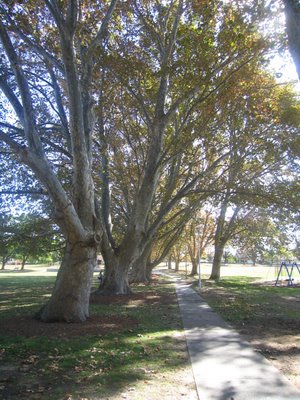
The Avenue of trees, planted about 1904

Arncliffe Park Part 2

Local women chat in the park

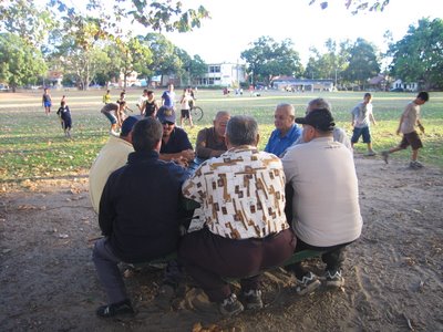
Local men chat in the park

The cricket nets

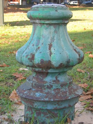
I don't know what this is, but suspect it might be the base of an old lamp post.


Children's playground

Sunday, 16 July 2006

Arncliffe Post Office opened 1884

Postal services began in Arncliffe in April 1878, and were located in various general stores until 1884 when they moved to the railway station. The station master, Mr W Marsden conducted the postal business from the railway booking office.

This handsome building of brick and stone was completed in March 1898. Part of it - which was probably the Post Master/Mistress's residence - is now a real estate agency. This lovely building remains one of the best examples of this kind of public building in Postcode 2205. It was restored in recent years.


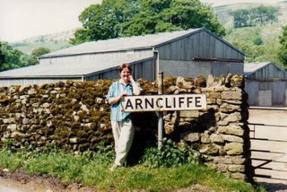
And here's the Post Office at Arncliffe, Yorkshire


Below, I am making a phone call from Arncliffe, Yorkshire to Arncliffe, Sydney


Tuesday, 25 April 2006

Cooks River Catchment: Muddy Creek

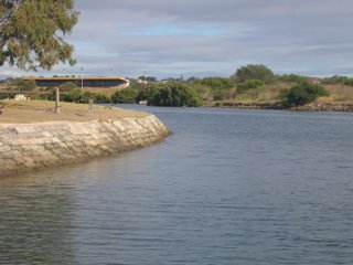
Muddy Creek outlet showing concrete channel and across to Sydney Airport.


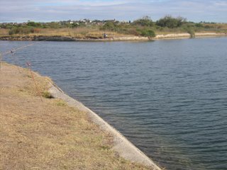
Fishing in Muddy Creek

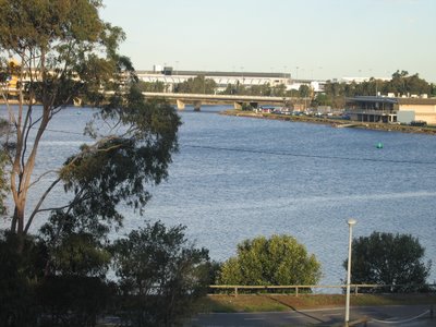
This shot and the next one show Muddy Creek where it meets the Cooks River. Directly opposite the mouth is Sydney Airport, which was once a large estuary of the Cooks River.


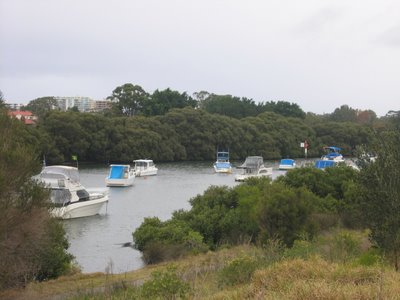
Boats on Muddy Creek near the Cooks River

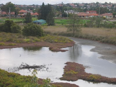
Muddy Creek is the Cooks River’s last tributary before it flows into Botany Bay. It drains stormwater runoff to the northeast from Carlton, Kogarah, Rockdale, Banksia, Brighton-Le-Sands and Kyeemagh.
It consists of a brick and concrete lined channel (owned by Sydney Water). There are market gardens alongside it.


Cooks River catchment - Wolli Creek 2

Wolli Creek where it meets the Cooks River at Tempe, looking upstream.

Looking upstream from the Wolli Creek / Cooks River confluence. The apartment blocks form part of the recently "invented" suburb of Wolli Creek (North Arncliffe). This area was a "brownfields" development - former light industrial - small factories, panel beaters, and even in the 1930s a film studio.


A Cape Barren Goose at Wolli Creek, upstream at Turrella.

Cooks River Catchment: Wolli Creek Valley

View from Nannygoat Hill. Shows the M5 exhaust stack, the creek, East Hills railway line, the high rise development on and near the Tempe House site at North Arncliffe (now renamed Wolli Creek). Sydney Airport is in the distance.

Wolli Creek looking downstream. A lovely urban creek. Generations of local kids have played in and around the creek and its bushland valley.

Nannygoat Hill. A 1967 proposal, defeated by local residents would have seen this hill levelled to provide fill for the Sydney Airport runway. The original 1978 plan for the F5 Freeway would have seen the east side (right hand side) of the hill completely removed for an 8-lane highway.


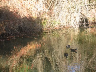
Ducks on Wolli Creek. There is also a myriad of local bird species living in and around the creek.

Wolli Creek is a tributary of the Cooks River. Upstream it is mainly confined to a channel, but through Postcode 2205 it is more or less “natural”. It flows into the Cooks River at Tempe railway bridge (you can see the railway bridge in the previous blog).

The Wolli Creek Valley contains the last patch of genuine bushland in the inner southwest of Sydney. It was under real threat when the M5 Motorway was planned to run through it. Fortunately strenuous campaigning by locals such as the Wolli Creek Preservation Society was successful in making the government decide to put the tollway underground (which has caused other problems not least pollution in the tunnel through inadequate ventilation, and the single smoke stack visible in the valley.

The valley is not safe yet – the road reservation has not been lifted, and there are delays in the development of the promised Wolli Creek regional Park, announced six years ago by the state government.

For more information, visit the Wolli Creek Preservation Society.

Cooks River 2

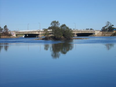
Looking east along the Cook's River and the bridge at Tempe. The island is called Fatima Island.

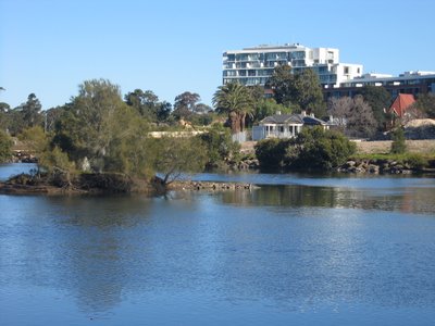
Fatima Island and Tempe House

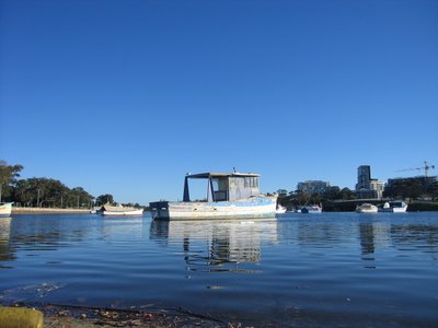
Boats on the Cook's River east of Tempe bridge (visible in the background)

Update - 4 July 2008.

I wondered how Fatima Island got its name. according to this Marrickville Council website:

"It was formed in 1901 and named after October 1951. Hundreds of Catholic nuns and children bearing torches made a ‘Rosary Crusade’ on the river banks in homage to the Virgin Mary symbolised in a statue of Our Lady of Fatima from Portugal. Pope Pius XII asked Catholics across the globe to pray to the Virgin Mary ‘with greater fervour of the heart as is demanded by the increasing urgency of the need’ as well as the conversion of Russia back from Communism."

At the time Tempe House, on the Arncliffe side of the river (see Tempe House blog entry) was a Good Sisters of St Benedict retreat.

Cooks River


Looking east from the Princes Highway to Sydney Airport. Photo taken from the cliff side of Mount Olympus at Tempe House.


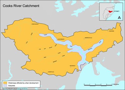
Cooks River catchment

Named after Captain James Cook, who journeyed up the river and into Wolli Creek on 3 May 1770.
The river is very different today to that which Cook described (see below). It has suffered all sorts of indignities, and is polluted, fishing is banned (though I notice a fair few people do so), much of it is confined to a concrete channel, it's a repository of all sorts of industrial discharge - both legal and illegal (including at least one cyanide spill). In short, it's in desperate need of rehabilitation.
On the other hand, it has some very pleasant parks and a cycleway along it, part of the Bay to Bay cycle track (Botany Bay to Homebush Bay).
The section in Postcode 2205 is between Muddy Creek and Wolli Creek. Downstream of Muddy Creek is its mouth, where the river flows into Botany Bay at Kyeemagh. Once it had a much larger estuary, a place of abundant food supply for Aborigines. The siting of Sydney's airport caused all that to be changed.
History
Captain Cook wrote in his journal:
"We found the face of the Country much the same as I have before described (diversified with woods, Lawns and Marshes) but the land much richer, for in stead of sand I found in many places deep black Soil which we thought was capable of producing any kind of grain, at present it produceth besides timber as fine meadow as ever was seen. However we found it not all like this, some few places were very rocky but this I believe to be uncommon, the stone is sandy and very proper for building."
Cook, of course, sailed away, never to return. It was left to those who came after to exploit the attributes of the area.
However, those who came later were not so optimistic. Captain John Hunter and Lieutenant Bradley both mentioned the shallowness of the water and large swamps, and instead of Cook's 'fine meadow', farmers of the colony went to the Parramatta and Hawkesbury rivers.
Land Grants and Early Activity
There were several large (average 100 acres) land grants along the river, but the major early industries were fishing and lime burning, especially around the mouth, where Aboriginal shell middens were used as the source of lime to supply the kilns to produce mortar for bricks. Casuarina trees were used for timber splitting to make shingles for the roofs of slab hunts and houses (no slate tiles were available until imported in 1828).
Gradually the need for additional food supplies became so great that the poriginal land grantees sold or leased their land to those prepared to try farming.
Alexander Brodie Spark of Tempe House (see previous blog)
Sparks's diary:
27th June 1838 "The Venison we dined on on Sunday was from a fine Buck that Willie the boatman found entangled in the mud of the river. All hands were called and the Dear was secured. On returning home I found possession disputed by some men who were about carrying him off in a Cart. I quickly rescued the prize, but the animal had been so much injured that he died in the night.
5th November, 1938 "Had a conversation with the Governor on the subject of damming up Cook's River for the purpose of obtaining a constant supply of fresh water for Sydney...
9th November, 1838 "Major Barney called on me afterwards in town and said that if I did not object to it the dam might be run across below the Bathing house, and the only apprehension was that my garden might be flooded. To be surrounded with the fresh water instead of salt would be highly desirable and I did not object to his proposal if he could previously ascertain that no bad consequence would follow...
In fact after the river was dammed, the water above the dam remained brackish (salty) and was not used for Sydney's water supply. The dam prevented tidal flushing of deposited silt and hastened the logging and pollution of the river in the future.
In 1840, Lady Franklin described the Tempe scene:
" To the left and behind Tempe, rock rises steep, but it of most significant height, thpough styled Mt Olympus - forms a sort of small promintory, at the foot of which is a small whark or jetty and bathing house - the intended dam starts a little higher on the opposite bank, takes a curve or bow upwards, and is to abut on this promontory - Sir G begins to think it will never be done for want of convict labour, no ships have come in for some time...view from Olympus of winding of river in flat bush and swamps, and see heads of Botany Bay - all ugly enough...garden walks at right angles crossing and Norfolk Island pines at intersections...orange and lemon trees...casuarina trees stripped of leaves and convenient branches planted in aviaries for perches of birds."
Industry
Upstream, a second dam was built, to serve the needs of the first manufacturing industry (at Canterburt) : Australian Sugar Company's refinery. The sugar company closed in 1855, but the passing of an Act banning noxious trades from Sydney itself meant other industries moved to the river: wool washes, tanneries and boiling down works. They all sent their industrial waste into the river.
Skinny dipping!
In the late 19th century, depite all this, the river was still a popular place for bathing, boating and picnics, although some men took their freedom too far, according to one angry gentleman from Petersham, who wrote to the Herald in 1891:
Sir, - I have often heard it said that it is impossible to take ladies down to Cook's River on Saturday afternoons and holidays. Last Saturday afternoon there was abundant evidence that this is the case. From 'Starkey's Corner' to Tempe there could be counted 30 to 40 men and boys openly bathing in a perfectly nude state, some standing on projkecting rocks without the slightest show of concealment. This is a state of things calling for summary treatment, and should not be allowed to continue. A few convictions would have a magical effect . . .
Development
The 188s were land boom years. Land was cleared, meaning faster runoff and silting of surface dust into river mudbanks. Blockage was caused as reed beds spread, fed by the rich urban silt. This in turn caused flooding.
Cleaning up the river
A report by engineer H B Henson in June 1896 made several recommendations, about the removal of obstructions, the construction of a canal from the Parramatta River into Cooks River, and the joining of the two rivers via a canal from Homebush Bay. All this was designed to flush the river with waters from the Parramatta River, and ultimately Sydney Harbour. Nothing was done, other than a fe desultory attempts at dredging.
In 1925, a group of citizens formed the cooks River Improvement League and published a book Our Ocean to Ocean Opportunity designed to arouse public anger in which they demanded drastic efforts be made to clean the river up. The Wolli Creek sewerage outflow was seen as the main culprit, making the river a health hazard. It took until half way through the Depression to find money to dredge part of the river and to begin waht seemed a good idea at thetime - the concreting of the banks.
The Cooks River Improvement Act of 1946 established the policy of tidying up the stream into neat cement boundaries with no unruly reed beds. The river mouth was diverted to accommodate the Mascot airport runways, and other diversions were made for road and bridge work.
The Cooks River report of 1976 made recommendations to begin restorative work, requiring the co-operation of the several councils which border the river.
The Cooks River Valley Association is a local pressure group which has lobbied for improvements. The cycle track, tree planting and landscaping is mainly due to the enthusiasm of these people. (see also Wolli Creek Preservation Society)
The fight continues. Here is the Cooks River Management Strategy.
The latest assault: Cooks Cove Development
The latest indignity Rockdale Council has planned is called Cooks Cove, including a "development zone" of "trade and technology" use - whatever that means - probably ugly warehouses - on land currently occupied by a golf course. What are currently private sporting facilites (and pretty ugly a lot of it!) would become occupied by the golf course. This development is opposed by many in the community, including the local branch of The Greens and Sydney Morning Herald architecture writer Elizabeth Farrelly. Here's a Master Plan.
Certainly a lot of the land is degraded, but is this the only way it can be fixed? I would hate to think so.
Much of the historical information is taken from the Canterbury Council's website which includes a history of the Cooks River.

Friday, 21 April 2006

Tempe House

The back of Tempe House, Mount Olympus to the right. April 2006
The grounds looking from the bottom of Mount Olympus to the Cooks River


Tempe House with lawns and development behind, April 2006

This house, now being magnificently restored, has quite a history – from glamorous high society home, to a school operated by early Sydney philanthropist Caroline Chisholm (she previously appeared on the Australian five dollar note), through nearly a century as a home run by Catholic Good Samaritan nuns for women adjudged to be in “moral danger”.

In the past few decades it has been in danger of total dereliction, the gardens and grounds overgrown and inaccessible.

Unfortunately, the only way the house has been able to be restored has been in conjunction with a major high-rise housing development. While I haven’t got an issue with the flats themselves, I do feel they mar the line of sight of Tempe House and divorce it from its context of expansive grounds. It has also meant the excision of a part of the rocky knoll to one side, called “Mount Olympus”. This part of the grounds has also been restored as a garden, for the private use of the apartment dwellers, but apparently the rest of the grounds will be publicly accessible.

On the positive side, the vast lawns down to the Cooks River have been rehabilitated (see the third picture above). Heritage architects Tanner and Associates have been undertaking the restoration work, and there is ongoing archaeological work.

Look at an early painting of Tempe House by Conrad Martens and you will see that trees lined the river bank. Apparently we are going to see a riverside boardwalk with cafes and shops. We wait to see what that will look like when it is finished.

There will also be a supermarket, extensive public parking 6 500 residents and 7 000 workers in the overall Wolli Creek Redevelopment Area. Rockdale Council’s Development Control Plan can be seen here.

History of Tempe House

(Most of the information in this section is taken from the book A Village Called Arncliffe by R.W. Rathbone (Wild and Woolley, 1997 ISBN 0 646 32627 9)

Alexander Brodie Spark: 1826 to 1856

The house was built for a wealthy and successful Scottish émigré, Alexander Brodie Spark. After achieving business success in London, Spark applied to emigrate to Australia, and arrived in Tasmania on 21 January 1823. Finding that not to his liking, he moved on to Sydney where he arrived on 17 February 1823. He opened a general store in George St, and eventually moved into wool exportation, and owned a ship. He was a major shareholder in the Bank of Australia.

On 10 August 1826, Spark purchased 110 acres of land in an area formerly known as Packer’s Farm, on the south bank of the Cook’s River. The only way to cross the river was by boat. Spark had a private boatman, “Old Willy”.

Brodie, who had travelled extensively in Europe, having undertaken the classical gentleman’s Grand Tour of classical sites, named the estate “Tempe” after the Vale of Tempe in Greece, and the rocky hill he named “Mount Olympus”.

Brodie was a great entertainer, and it soon became apparent that the cottage on the site was inadequate, so in 1834 he commissioned John Verge to design an arcadian villa with resemblance to a Greek temple. Verge was a major colonial architect, responsible also for Elizabeth Bay House and Camden Park at Menangle. Verge also designed Spark’s previous home, Tusculum, at Potts Point (see below)

Tempe was completed in 1836, and Brodie made it his permanent home, leasing Tusculum, to the Anglican Bishop of Sydney.

Behind Tempe House there was an orchard, greenhouse, shrubbery and gardener’s cottage. On the river he constructed a rococo bathing house.

Damming the river

In 1839, a decision was made to dam the Cooks River to provide a more dependable water supply for the growing city of Sydney. This was completed with convict labour in May 1840. Spark even accommodated it by moving his bathing house. However, the dam was a failure because the water upstream was brackish.

The dam did, however, spark a land boom in 1839-40, assisted by the end of the land grants system. Spark over-extended his finances to buy more land, which was his undoing. The bubble burst in September 1840 and land values plummeted, along with declining prices for wool and livestock, and a further period of drought. Spark was declared bankrupt in August 1843.

Although he lost ownership of Tempe to the Australian Trust Company, Spark and his growing family - he married a widow Frances Radford (nee Biddulph) in 1840, and they had six children, as well as two from her previous marriage - stayed on as tenants in vastly reduced circumstances.

Spark died in October 1856. There were no obituaries, and he is buried in an unmarked grave in St Peter’s Church cemetery, Tempe. I do not know what became of his wife and children. Here is a portrait of two of his children, Edith and Stanley, painted about 1849 to 1851. Read more about Spark and his art collection here.

After Spark, before the nuns: 1856 to 1884

In December 1856 there was a partial subdivision of Tempe Estate into 123 suburban lots of between ½ and 2 acres. There was little interest and it was withdrawn in April 1859 and re-sub-divided.

The house and 11 surrounding acres were one lot, and the remainder were 1 to 20 acres.

Tempe was bought by two bachelor brothers, Patrick and Thomas Maguire of George St, Sydney. They paid £ 2000. Neither brother ever lived at Tempe, and it was occupied by a series of wealthy tenants. It was known as Greenbank at this time. The large block of flats immediately behind Tempe House is named Greenbank. The other is named Verge.

Probably the most notable tenant was Caroline Chisholm, dubbed “the immigrants’ friend”. She leased it to run “an educational establishment for young ladies”, until ill-health forced her to abandon it.

In October 1884, the surviving brother, Thomas, died and the house was sold to Frederick Gannon, the son of a local inn-keeper and landowner. On22 March 1885, he paid £ 4000, and five weeks later sold it to the Sisters of the Good Samaritan of St Benedict, making a £ 2000 profit. Property speculation is not a new phenomenon in Sydney!

St Magdalen’s Retreat: 1884 to 1983

The Sisters conducted a refuge for destitute women, and an industrial laundry in Carters’ Barracks, Pitt St, Sydney. Upon purchase of Tempe House, it was renamed St Magdalen’s Retreat, and opened in October 1887 with 25 women from Pitt Street. St Magdalen’s operated for 96 years.

In 1888 the chapel was constructed.

Gradually the function changed from accommodation for destitute women to one primarily for women unable to find employment and in danger of prostitution. Former prostitutes, ex-prisoners and alcoholics were accommodated for two years to work in the laundry, dairy or poultry yard. Younger women were taught cooking, sewing and other domestic duties.

Originally the women accommodated were all volunteers, free to leave at any time, and then the courts increasingly referred young women judged to be in “moral danger”.

Security was increased, with a double corrugated fence ten feet high around the dormitory and laundry. Rathbone reports this as being due to outbreaks of sectarian bigotry, and various attempts to “rescue” the girls against accusations of being mistreated and exploited.

In 1919 there was a full inquiry, which dismissed the allegations and found that th Sisters treated the residents with kindness, and that there was no basis for criticism of the work methods or wages paid. 1923 and 1929 changes t the Child Welfare Act put more emphasis on academic skills.

The Good Samaritan Sisters’ St Magdalen’s Retreat closed in 1983.

After the Sisters: 1983 --->

I believe that the house was sold to Qantas which had some plans to use it as a training base, but that never came to fruition The house and grounds quietly disintegrated until it was eventually sold to developers, the results of which we see today.

*Tusculum was built on land granted to Spark in 1828 – one of the few land grants to private individuals. Verge’s plan was approved by Governor darling in 1830 and completed in 1835. It was named after the villa built by the ancient Roman orator and statesman Cicero near Rome. Sparke only occupied the house for a short time. That house, like Tempe, gradually fell on hard times and in 1983 was acquired by the State Government. Conservation work was supervised by Clive Lucas. Today it is the home of the Royal Australian Institute of Architects NSW Chapter.

In my view it is a pity that the same was not done for Tempe House, which may have spared us the inappropriate development.

Wednesday, 19 April 2006

Chinese market gardens

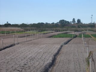
Above: The back of the Market Garden looking over the Riverine Park wetland towards West Botany Street. Below: Views from West Botany Street.


Chinese market garden, 212 West Botany Street.
Look carefully and you can see the control towers of Sydney airport in the background. Not the very high towers - they are sports ground lights. The towers to the left of the left most tall lights.
[The effect of the airport on Arncliffe will be a future blog].

There are many people of Chinese heritage who have arrived in the area quite recently- since China relaxed the rules about emigration, and since the handback of Hong Kong. But the Chinese in the Arncliffe area have a much longer history. There have been Chinese people in the area since the 1800s.

This garden is one of only three remaining in the inner Sydney area. It is on the State heritage List, where it states that it was first occupied by Sun Kuong-War, Lee How and Sin Hop Sing in 1892. The current owner is the State Government (Department of Planning), but it is farmed by Chinese people.

Amazingly, despite the enormous change in the area, this land has been in continuous use as a market garden for 114 years.

When I visited today there were two people working - one along the rows of vegetables, the other wheeling a barrow. Both wore the conical-shaped hats typical of Chinese farmers.

Market Gardens - a bit of history

After the Gold Rushes of the 1850s, several former miners and newer arrivals from China (though drastically fewer than in the 1850s and 60s) established market gardens - many in the Botany Bay area.

By 1894, the local property directory listed market gardens run by Sam How Long, Yee Mow and Gee Sing in Arncliffe Street (now mainly light industry, car smash repairers, an indoor go-kart place, and most recently, some "luxury" high rise apartment development). Ah Choy and Yok Sing were in Bonar and Illawarra Streets, and at the northern end of Wollongong Road Ah Jack, Sun Sam Long and Mow Sing are listed.

The land that is now Arncliffe Park was a Chinese market garden.

For much of the Interwar years, and especially in the Great Depression, Chinese market gardens were the only source of vegetables for urban Australians.

See here for heritage listing details.

Here some Chinese Australians recount their experiences, including with market gardening.

Tuesday, 18 April 2006

The original inhabitants of Arncliffe


The original inhabitants of the area were (perhaps) the Gweagal clan of the Dharug Nation. There does seem to be some confusion about this. One souce , the National Trust, says that the Gweagal people lived on the southern side of the Cooks River as far as the Georges River, from the shores of Botany Bay inland towards Liverpool. Other sources place the Gweagal people on the south side of the Georges River.

Anyway, the river provided fish, oysters, crustaceans, waterfowl and the valleys birds, eggs, possums, snakes, wallabies, goannas, wild honey, berries and nuts - in short, an abundant food supply.

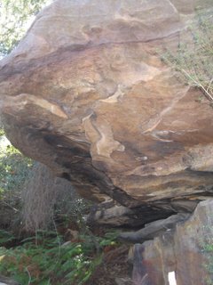
Valleys of Wolli Creek and Bardwell Creek contain evidence of Aboriginal presence in smoke-blackened caves. (I took this photo on Nannygoat Hill *, a rocky outcrop amongst a stand of bushland along Wolli Creek). However, it appears that these may have acted as temporary shelters only for hunting parties, as the people lived more permanently along the abundant shores of Botany Bay. Middens have been found along the Bay, and the river, and were one source of lime in the days when lime was burned in order to provide the substance for the bricks and mortar for Sydney buildings.

The northern part of Arncliffe (now a high-rise housing subdivision called Wolli Creek) and some parkland is bordered by the Cook's River, named after - well, yes - Captain James Cook.

You can meet a Gweagal man, Rod Mason, an Aboriginal Discovery Ranger at Botany Bay National Park, at this website of the National Parks and Wildlife Service.

* Nannygoat Hill isn't itself in Postcode 2205, but it has great views over the entire area!

Where's Arncliffe?

Arncliffe is an inner southern suburb of Sydney in the - part of the St George district. It is situated about 10 km south of central Sydney. It's been my home for the last 22 years, and I love it, even if it has absolutely no glamour and you are never likely to find it on a list of desirable Sydney suburbs!

Arncliffe's name comes from a small village in North Yorkshire, England.


Me at Arncliffe, North Yorkshire

Ron Rathbone, a local historian, in his book "A Village Called Arncliffe" says that an early land speculator, William Hirst, created a subdivision in 1840. It was named The Village of Arncliffe Estate. William Hirst was born in Settle, Yorkshire. Settle is a market town serving a cluster of villages, of which Arncliffe is reputed to be the prettiest. Rathbone says it is likely that Hirst gave Arncliffe its name, although it was more than two decades before it received official recognition.

The street I live in runs into Hirst Street, obviously named after William Hirst.