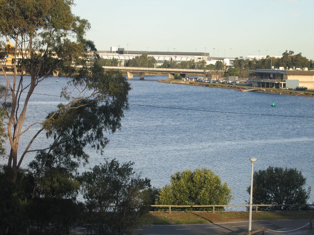
 Looking east from the Princes Highway to Sydney Airport. Photo taken from the cliff side of Mount Olympus at Tempe House.
 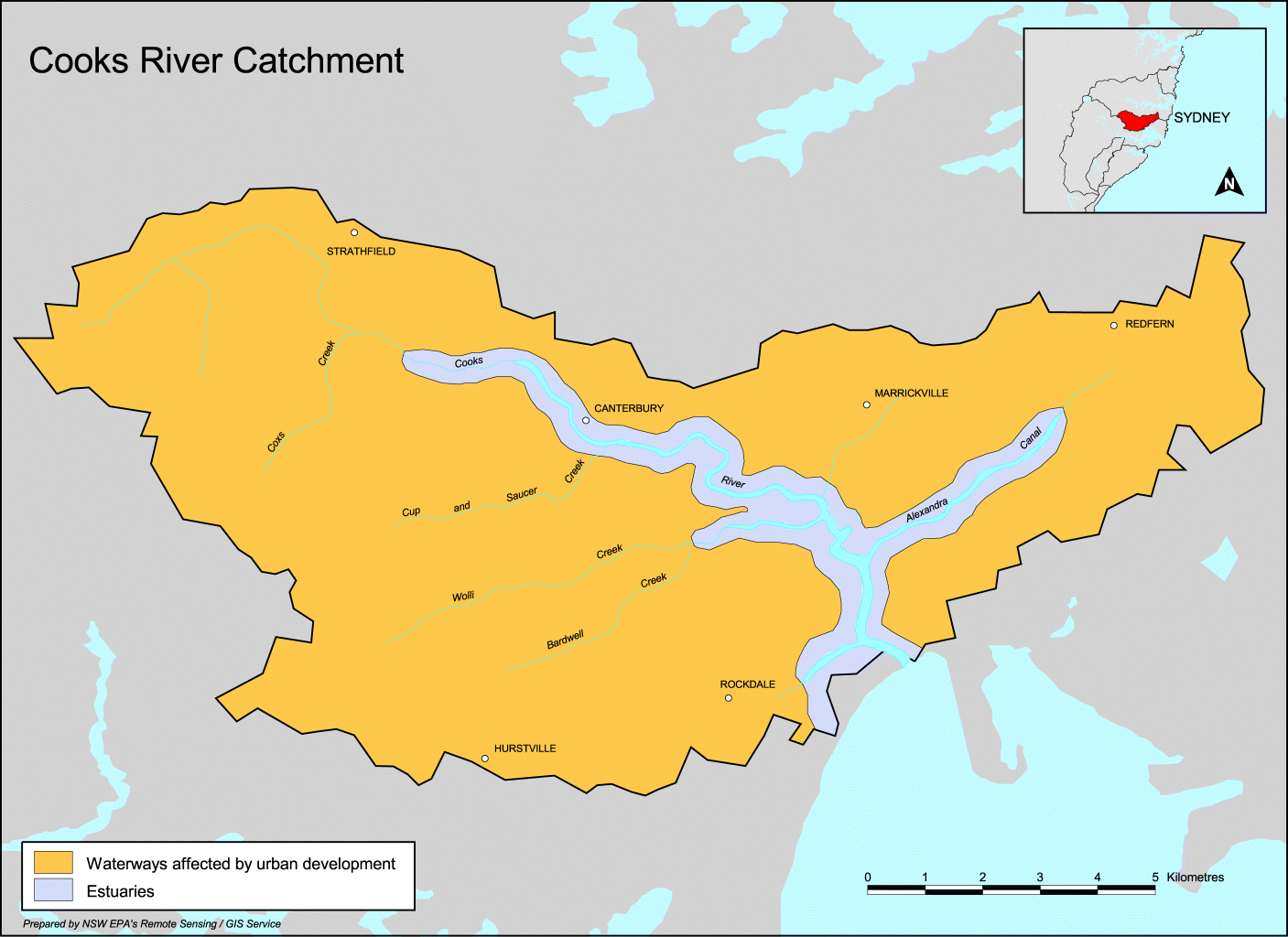 Cooks River catchment
Named after Captain James Cook, who journeyed up the river and into Wolli Creek on 3 May 1770.
The river is very different today to that which Cook described (see below). It has suffered all sorts of indignities, and is polluted, fishing is banned (though I notice a fair few people do so), much of it is confined to a concrete channel, it's a repository of all sorts of industrial discharge - both legal and illegal (including at least one cyanide spill). In short, it's in desperate need of rehabilitation.
On the other hand, it has some very pleasant parks and a cycleway along it, part of the Bay to Bay cycle track (Botany Bay to Homebush Bay).
The section in Postcode 2205 is between Muddy Creek and Wolli Creek. Downstream of Muddy Creek is its mouth, where the river flows into Botany Bay at Kyeemagh. Once it had a much larger estuary, a place of abundant food supply for Aborigines. The siting of Sydney's airport caused all that to be changed.
History
Captain Cook wrote in his journal:
"We found the face of the Country much the same as I have before described (diversified with woods, Lawns and Marshes) but the land much richer, for in stead of sand I found in many places deep black Soil which we thought was capable of producing any kind of grain, at present it produceth besides timber as fine meadow as ever was seen. However we found it not all like this, some few places were very rocky but this I believe to be uncommon, the stone is sandy and very proper for building."
Cook, of course, sailed away, never to return. It was left to those who came after to exploit the attributes of the area.
However, those who came later were not so optimistic. Captain John Hunter and Lieutenant Bradley both mentioned the shallowness of the water and large swamps, and instead of Cook's 'fine meadow', farmers of the colony went to the Parramatta and Hawkesbury rivers.
Land Grants and Early Activity
There were several large (average 100 acres) land grants along the river, but the major early industries were fishing and lime burning, especially around the mouth, where Aboriginal shell middens were used as the source of lime to supply the kilns to produce mortar for bricks. Casuarina trees were used for timber splitting to make shingles for the roofs of slab hunts and houses (no slate tiles were available until imported in 1828).
Gradually the need for additional food supplies became so great that the poriginal land grantees sold or leased their land to those prepared to try farming.
Alexander Brodie Spark of Tempe House (see previous blog)
Sparks's diary:
27th June 1838 "The Venison we dined on on Sunday was from a fine Buck that Willie the boatman found entangled in the mud of the river. All hands were called and the Dear was secured. On returning home I found possession disputed by some men who were about carrying him off in a Cart. I quickly rescued the prize, but the animal had been so much injured that he died in the night.
5th November, 1938 "Had a conversation with the Governor on the subject of damming up Cook's River for the purpose of obtaining a constant supply of fresh water for Sydney...
9th November, 1838 "Major Barney called on me afterwards in town and said that if I did not object to it the dam might be run across below the Bathing house, and the only apprehension was that my garden might be flooded. To be surrounded with the fresh water instead of salt would be highly desirable and I did not object to his proposal if he could previously ascertain that no bad consequence would follow...
In fact after the river was dammed, the water above the dam remained brackish (salty) and was not used for Sydney's water supply. The dam prevented tidal flushing of deposited silt and hastened the logging and pollution of the river in the future.
In 1840, Lady Franklin described the Tempe scene:
" To the left and behind Tempe, rock rises steep, but it of most significant height, thpough styled Mt Olympus - forms a sort of small promintory, at the foot of which is a small whark or jetty and bathing house - the intended dam starts a little higher on the opposite bank, takes a curve or bow upwards, and is to abut on this promontory - Sir G begins to think it will never be done for want of convict labour, no ships have come in for some time...view from Olympus of winding of river in flat bush and swamps, and see heads of Botany Bay - all ugly enough...garden walks at right angles crossing and Norfolk Island pines at intersections...orange and lemon trees...casuarina trees stripped of leaves and convenient branches planted in aviaries for perches of birds."
Industry
Upstream, a second dam was built, to serve the needs of the first manufacturing industry (at Canterburt) : Australian Sugar Company's refinery. The sugar company closed in 1855, but the passing of an Act banning noxious trades from Sydney itself meant other industries moved to the river: wool washes, tanneries and boiling down works. They all sent their industrial waste into the river.
Skinny dipping!
In the late 19th century, depite all this, the river was still a popular place for bathing, boating and picnics, although some men took their freedom too far, according to one angry gentleman from Petersham, who wrote to the Herald in 1891:
Sir, - I have often heard it said that it is impossible to take ladies down to Cook's River on Saturday afternoons and holidays. Last Saturday afternoon there was abundant evidence that this is the case. From 'Starkey's Corner' to Tempe there could be counted 30 to 40 men and boys openly bathing in a perfectly nude state, some standing on projkecting rocks without the slightest show of concealment. This is a state of things calling for summary treatment, and should not be allowed to continue. A few convictions would have a magical effect . . .
Development
The 188s were land boom years. Land was cleared, meaning faster runoff and silting of surface dust into river mudbanks. Blockage was caused as reed beds spread, fed by the rich urban silt. This in turn caused flooding.
Cleaning up the river
A report by engineer H B Henson in June 1896 made several recommendations, about the removal of obstructions, the construction of a canal from the Parramatta River into Cooks River, and the joining of the two rivers via a canal from Homebush Bay. All this was designed to flush the river with waters from the Parramatta River, and ultimately Sydney Harbour. Nothing was done, other than a fe desultory attempts at dredging.
In 1925, a group of citizens formed the cooks River Improvement League and published a book Our Ocean to Ocean Opportunity designed to arouse public anger in which they demanded drastic efforts be made to clean the river up. The Wolli Creek sewerage outflow was seen as the main culprit, making the river a health hazard. It took until half way through the Depression to find money to dredge part of the river and to begin waht seemed a good idea at thetime - the concreting of the banks.
The Cooks River Improvement Act of 1946 established the policy of tidying up the stream into neat cement boundaries with no unruly reed beds. The river mouth was diverted to accommodate the Mascot airport runways, and other diversions were made for road and bridge work.
The Cooks River report of 1976 made recommendations to begin restorative work, requiring the co-operation of the several councils which border the river.
The Cooks River Valley Association is a local pressure group which has lobbied for improvements. The cycle track, tree planting and landscaping is mainly due to the enthusiasm of these people. (see also Wolli Creek Preservation Society)
The fight continues. Here is the Cooks River Management Strategy.
The latest assault: Cooks Cove Development
The latest indignity Rockdale Council has planned is called Cooks Cove, including a "development zone" of "trade and technology" use - whatever that means - probably ugly warehouses - on land currently occupied by a golf course. What are currently private sporting facilites (and pretty ugly a lot of it!) would become occupied by the golf course. This development is opposed by many in the community, including the local branch of The Greens and Sydney Morning Herald architecture writer Elizabeth Farrelly. Here's a Master Plan.
Certainly a lot of the land is degraded, but is this the only way it can be fixed? I would hate to think so.
Much of the historical information is taken from the Canterbury Council's website which includes a history of the Cooks River.

3 comments:
fabulous blog - I discovered it by chance. I must say I normally hate blogs because they are often written by people with very little interesting to say, but not in your case. You write very well, you cover very interesting topics and your social conscience is obviously in the right place - good on you and many thanks for an excellent and informative piece. Keep fighting the good fight! High quality photography as well. Thanks again. Cheers, Daniel
Dear Sally - what a wonderful site you have created. My husband and I have been looking at moving to the area and you have made our decision so much easier.
A truly wonderful burb steeped in history. When we move we will join the community with open arms and hearts.
Thanks so much again.
Leonie & Gerry
Great to welcome you leonie and Gerry! How's things going?
Post a Comment